

San Joaquin River Fishing Overview
California’s second-largest river runs 366 miles from its headwaters in the high Sierras to the Sacramento-San Joaquin River Delta. Its upper section is formed by three forks that join in the Sierra National Forest. The main stem of the river flows into the San Joaquin valley and holds multiple dams built for irrigation and hydropower. The north, middle, and south forks are home to rainbow, brown, and brook trout, as well as some golden-rainbow hybrids. The forks are much smaller remote mountain streams. The middle fork is the most popular due...
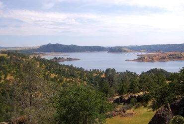
California’s second-largest river runs 366 miles from its headwaters in the high Sierras to the Sacramento-San Joaquin River Delta. Its upper section is formed by three forks that join in the Sierra National Forest. The main stem of the river flows into the San Joaquin valley and holds multiple dams built for irrigation and hydropower.
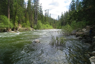
The north, middle, and south forks are home to rainbow, brown, and brook trout, as well as some golden-rainbow hybrids. The forks are much smaller remote mountain streams. The middle fork is the most popular due to its accessibility and proximity to Mammoth Lakes. The north fork is the smallest and least accessible but holds strong populations of rainbows and brook trout. The south fork is the largest and contains some dams, but still retains good numbers of trout.
The main stem of the San Joaquin offers the highest concentrations and largest-sized fish. Above Mammoth Pool, the river receives large volumes of runoff and is not fishable until late summer most years. Below Mammoth Pool, the river runs through a deep canyon making access difficult but excellent trout populations exist. River insects including golden stoneflies, caddis, and blue wing olives are the main food sources.
Chinook salmon restoration efforts are underway to rebuild a population in the lower river below Millerton Lake. A section of the river runs dry here due to water diversion for farming. The river regains flow at the confluence of the Merced River.
Much of the upper San Joaquin can only be accessed by hiking. Portions of the middle fork have road access and campgrounds near Mammoth Mountain. As the river approaches Fresno and the San Joaquin valley, amenities and access become more available.
|
South Fork |
TroutCDFW |
|
South Fork |
TroutCDFW |
|
South Fork |
TroutCDFW |
Nearby Reports
The McClure salmon bite really picked up early last month, but with the summer season here, increased water temps and boat traffic have negatively impacted the bite. Limits up...
Main river still a bit high along 108 to Kennedy Meadows. Fished along it and Clark’s Fork. Another great day. River was clear with light rain off and on. All catch and...
Nearby Lakes & Rivers


